for years i have been hearing about the grandeur of the wallowa mountains in the eagle cap wilderness in eastern oregon. to be honest, i had no idea what the heck people were talking about. the cascade range is super evident. the mountains (aka volcanic peaks) that surround me here are obvious. but i have driven where the wallowas lay across the land, and have never seen them, or i had seen some snow-covered tips, but… really? isn’t it just dry farm land?
we all went about our morning routines in our own paces. we exchanged gear relevent to our trips. they went to drop the bike tour friend to their starting point while i went to the trail head (and still trying to find a map). i filled up my favorite mug with some hot coffee and walked around the trail head area. the land already felt special in ways that seemed familiar while completely unknown.
we had picked a loop that would take us around the lake basin and over a couple of passes. many people do the lake basin loop, but go the opposite way and not as far east as we had chosen. when my friend arrived, we put on our packs, took pictures of important parts of the backpacking book, since we could not find a map anywhere (!) and headed up the trail….literally straight up!

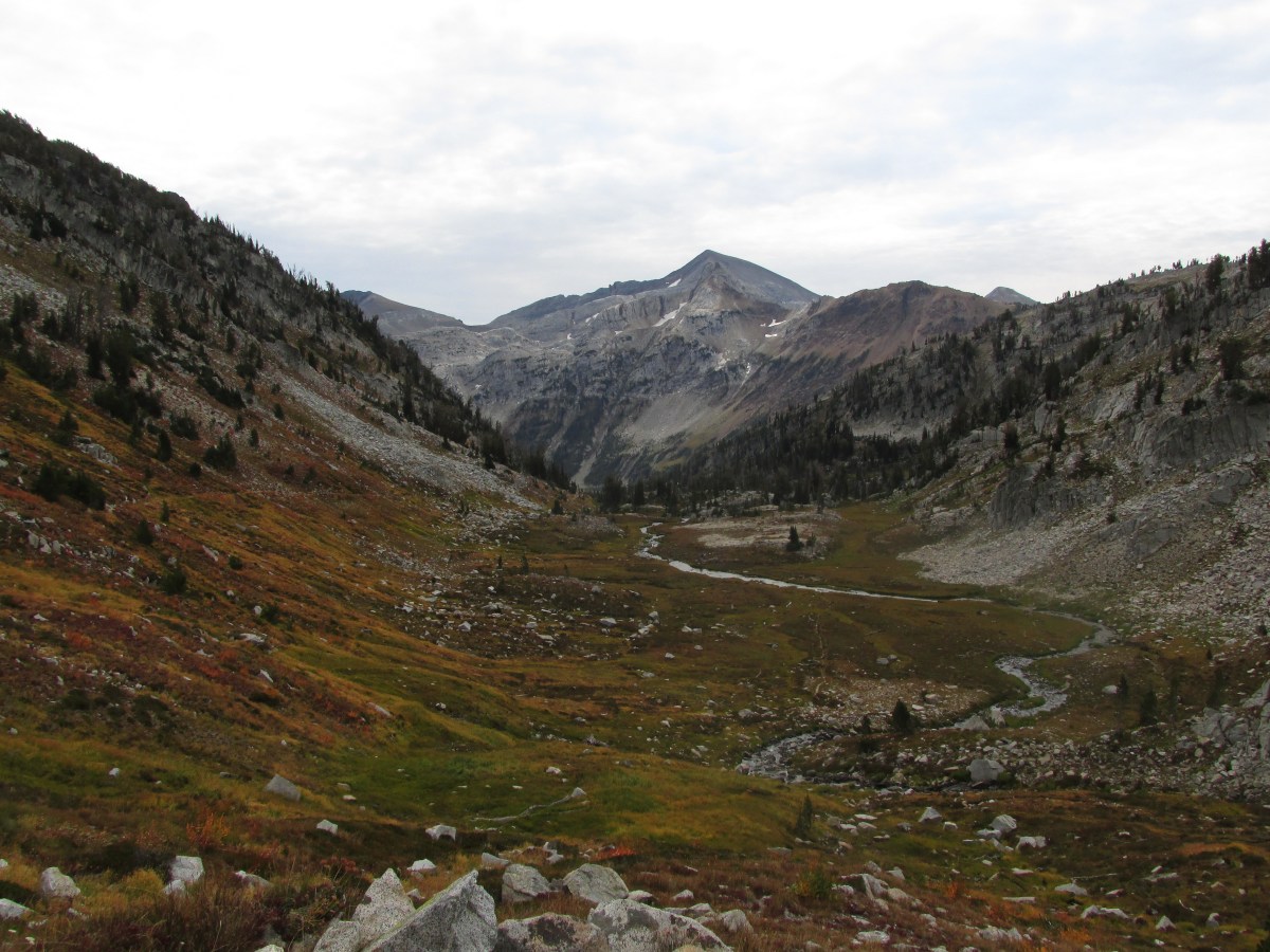
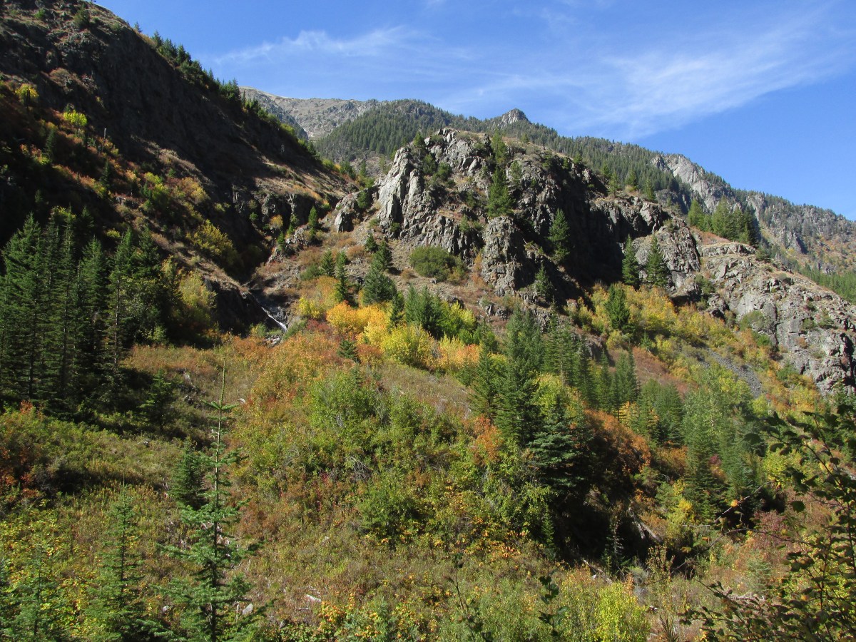
we found a comfortable pace and set into a nice conversation. i realized i have this thing that i do when i’m on climb, i like to look back and see how quickly i’ve climbed so high relative to where i had started. for some reason it takes the view ahead of how much further i have to go seem “well look what i have already done, so of course i can do this” but also, the higher we got, the more amazing views we had of wallowa lake (where we started the morning). once we to the last view-point of the lake before taking a turn that would leave the lake and all that has happened leading to this adventure behind us, we could see this line. its a line that marks the end of lush forest to dry arid farmland. its such a distinct line from up above, even though i had moved slowly through the lines and could see the effects of the changing landscape… its like if you have ever gone up and walked a clear-cut. you feel the heat radiating off the bare-naked land. can feel the sun cooking the once nutrient dense soil. then you walk into what is left of the forest and see just how deep the effects of that clear-cut goes…at least as much as my above-ground eyes can see.
i gave pause at this as i made that turn. something caught in my chest that i wouldn’t understand until later.
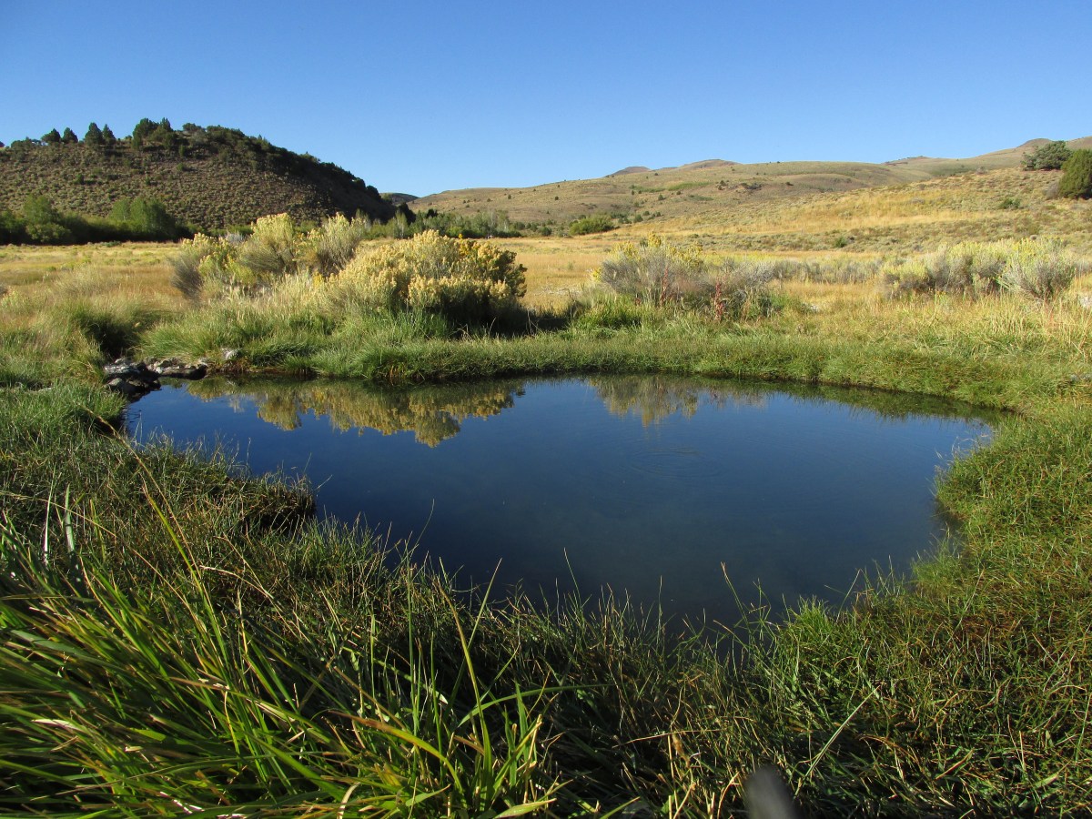
we rounded the turn and came to a little place, like a pond along the river we were following and took a little break. it was so peaceful. as we chatted, both of us wondering what and where we would want to go as portland is becoming harder and harder to live creatively in, when we see this shack across the stream. there is this water divergent pump station here with a bridge that leads over there (naturally (?) there is a locked gate with warning signs about crossing. but our imaginations cross anyway. we both agree. living in such a place would totally be doable! it’s just the right size! we could do this thing over there, and so and so could do their thing and…. seems fences can’t keep out the dream. meanwhile, there were these super cute little birds diving into the depths of the pond to feed and entertain us (pretty sure the entertainment was a side effect).

when we got to roger lake, just before anoroid lake, we had a little lunch. here is where we saw the first people since we took off (ok maybe we saw some others, but not many and we were talking so that didn’t count) it was a group of women and we all just sort of waved to one another in an acknowledgment of wow women hiking with no men to show them the way! (well ok that is what i was thinking). we were both tired, but feeling good. if we camped at anoroid lake (which for some reason, i’m a lazy reader, i kept calling android lake) it was going to be a short mileage day. so when we got to r2d2 lake, we decided to keep going. we were sure that there was another lake close by and some streams for water when we looked at the book’s map (why the hell could we not find a map to buy before we left!)…so we decided to keep going for the day…but then we had to keep going…and going…and then we were over tenderfoot pass and the wind hit us like crazy and because once on top we just stayed up, there was no stopping it.

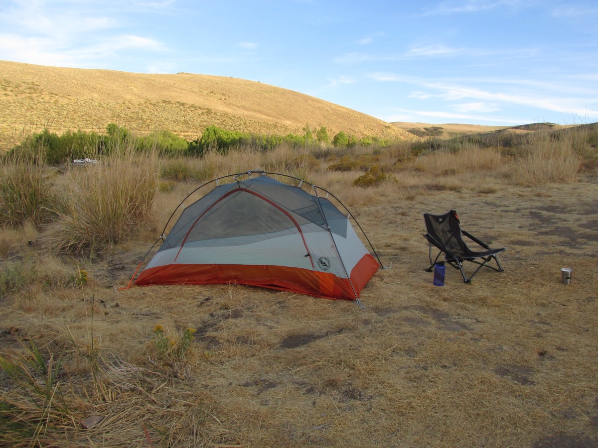
we finally came around the corner to the saddle the wind was whipping through, not that it slowed it down, but we did see a solo packer setting up a tent… a really big tent for one person and her dog. so here is where we decided we would find a place to set up camp for the night. there was no water and we just had enough to get us to the stream at the other side of the pass we would have to climb in the morning… dry snack dinner it was.
it was getting cold and the wind maybe was a little calmer where we set up behind a bluff. we pitched our tents with our doors facing each other (we used both of the single person tents i have which have side facing doors (why do people use front facing doors?) so we snuggle into our respective sleeping vessels and chatted up the night. as the sun went down so did the wind and the night was moon filled and peaceful!


we woke to frost everywhere! but the sun quickly came over the ridge and warmed up and all the things. water bottles were frozen so we had a dry breakfast and packed up and went in search of the trail to polaris pass that would take us into the lakes basin.
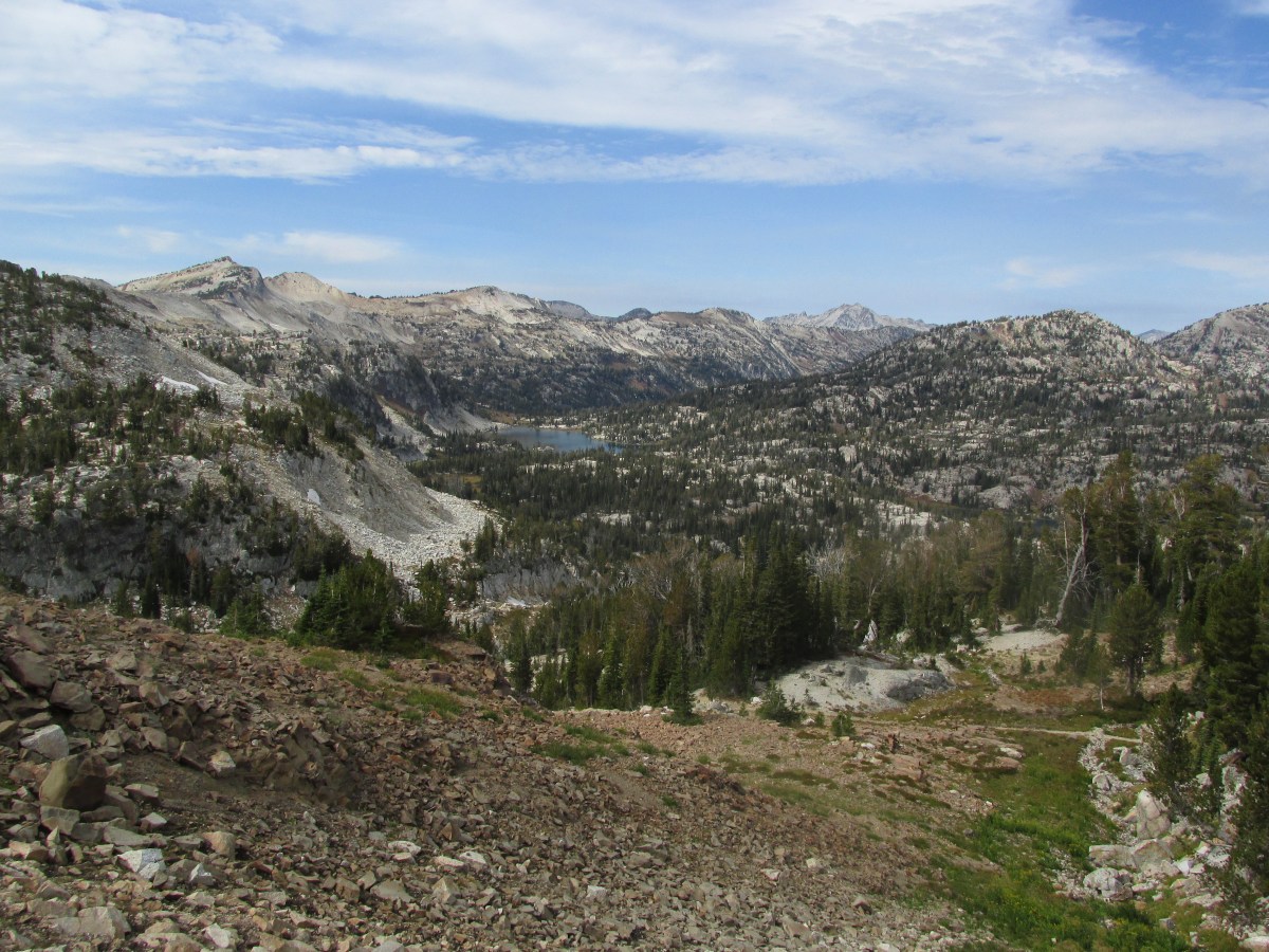
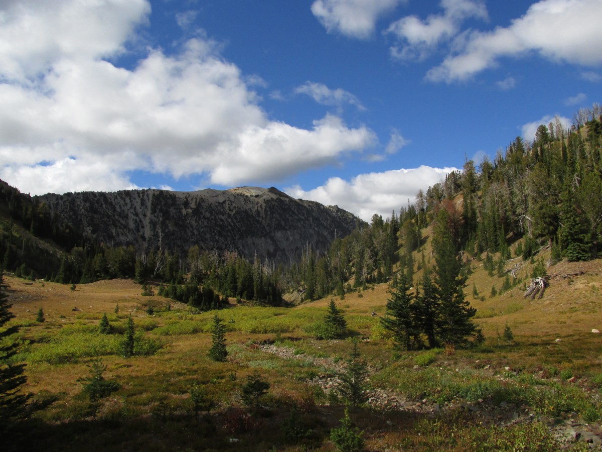
it was a climb, but the trail was a gentle climb. with views that were incredible and we were able to warm up quickly. when we got to the top of the pass, we could see how people would follow the ridge lines to the tops of peaks, we could see the trails at the bottom and all the directions and pockets with cute lakes and trees. this pass was warm and gentle and quiet… we had a long break up here….and then we started down and
down
and
down
and
down.
one reason that i was given for not being able to buy a map at one of the mt shops i frequent, is that they only carry green trails maps and since the trail systems here are incomplete or not frequently maintained, there aren’t green trails maps…. i thought about this for a minute. then i thought about some books that described hikes in this area and that for many reasons, the trails aren’t maintained much. this all rattled in my brain for a moment as i looked down at what could be construed as a trial through the scree (a shear side of a ridge where sometimes there is a slight flattened area where the rocks are to be walked upon) and wondered “how the hell would one even begin to maintain such a trail?” {a couple of days later we ran into a ranger who was doing trail maintenance and said as much to him. his response was he wondered the same but more so how do you even cut such a trail in the first place…yup!} my mind went staggeringly along as i decided that yes, i must find a way to do work with local groups as i pass through communities, and do some trail maintenence while i’m on by big walk.

we went through some amazing places in our downward descent, but couldn’t look unless we stopped our perpetually moving forward bodies for fear of falling victim to the strong gravitational forces, however, we did run into 2 really nice women who were going the opposite direction as us. they were actually counting the switchbacks and let us know where we were in relation to those numbers… i can never keep track of such information, but soon i could see then hear the water from the stream that we were waiting for, and ooooh! what a waterfall stream it was! i kicked off my shoes, filled up all my water vessels and sat the fuck down! it was amazing. the water was cold and crisp and sweet… i have some addictions for sure, but my main addiction is for wild water, untreated, unfiltered, and straight into my mouth! i cupped my hands and drank.
we sat here for a spell. had a snack or two.
from here it wasn’t far to frazier lake and then the full on lakes basin. we had decided that we would camp at frazier, then horseshoe lake, and then head out. this would give us the time to see the things, take our time and have enjoyable nights and afternoons at the lakes. we wanted to enjoy and experience with out being rushed… some friends were getting married at the end of the adventure and wanted to get back in time for some celebrations.

i don’t know how to talk about the rest of the trip.
the land is magical
the lakes are pristine
all of this should be experienced for one’s self
we learned about the cut-offs and connections that could make for shorter or longer trips to see this and be in this landscape.
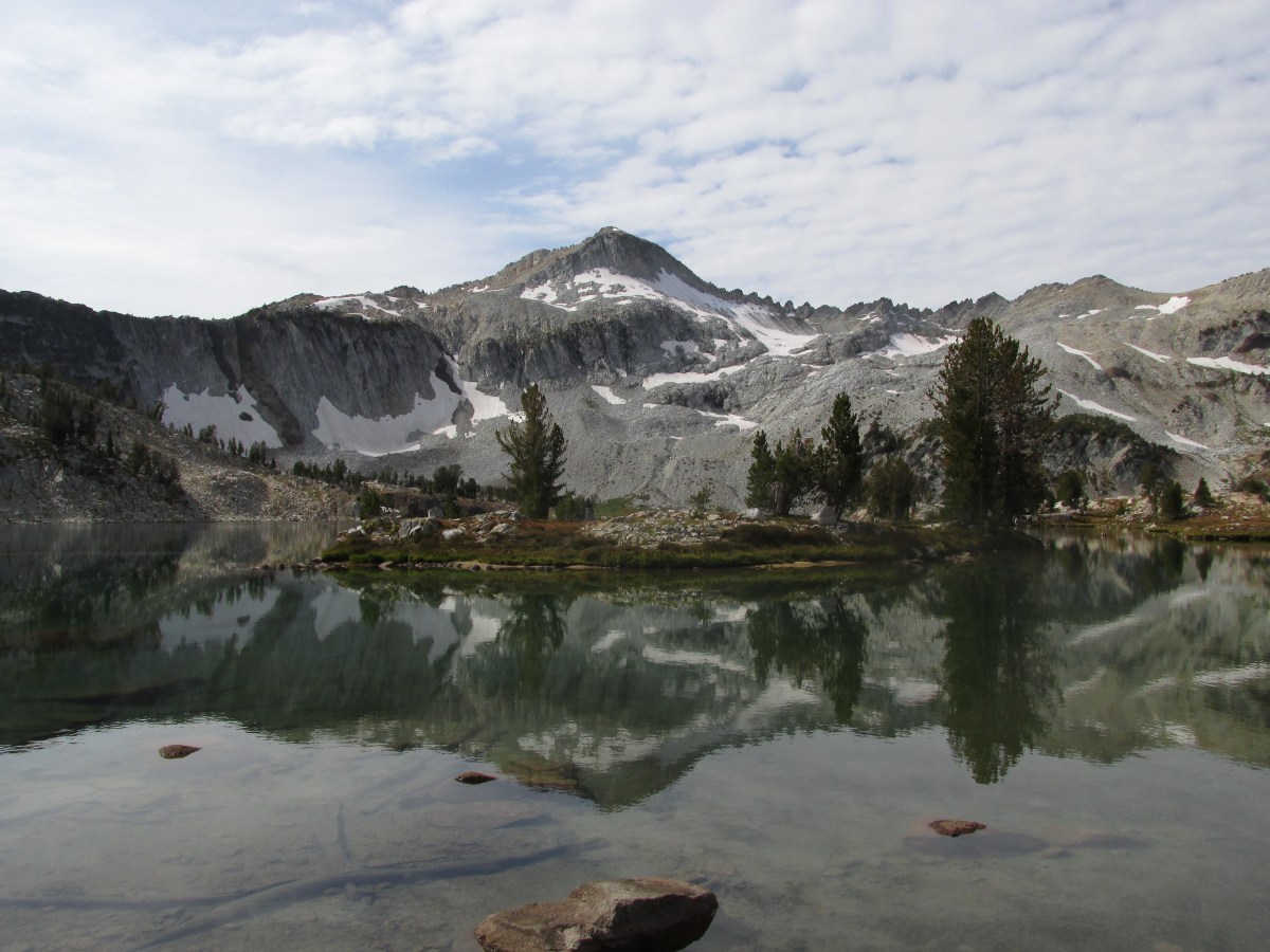
what i can say is that view you see in countless oregon hiking and backpacking books of glacier lake will never ever do it justice, not even the one that i have here!
but what i can say is that i sat there in awe with tears in my eyes at the wonder i could see and smell and feel and taste. that the quiet i let settle into my body and mind, was to prepare me to be here in this place now! to not miss a reflection of mountain and tree in the water, or the ripple of a fish jumping, or the tiniest of tiny frogs huddled together at the edge of a lake.
i can tell you that i know there are people who came before us (white people of european descent) who cared for (and still do) this land. and again i had this feeling that i was forgetting something that i should remember.
this feeling happened everywhere….glacier pass, moccasin lakes, following the wallowa river,at the top of a pass, and when we returned to the lake to meet our other friend.
that last night, when we had all gathered back at the brewery for some fresh greens and hops, i took my time getting back to camp. i knew i was missing something, some important piece of all this.
the next morning they took off for a hike before their return to portland. i took my time packing up and trying to decide where to go and what to do next before i had to be back myself. i don’t do weddings so much, but i wanted to celebrate with them at the after party (aka reception).
i stopped at the turn off for old chief joseph’s grave site, got out of the car and read the plaque. i have read many of the stories of this leader, and his son, chief joseph, of a people during a horrible moment (of many) in the history of this colonized country. i walked up to his gravesite (that had to be moved from the summer gathering place of his people because it had been robbed twice – what is wrong with people), and my eyes filled with tears. joseph isn’t just a random name given to this town. it is named after old chief joseph of the wallowa band of the Niimiipuu [Nee-Me-Poo] (commonly called the Nez Perce and his people the “non-treaty” nez perce since they refused to sign a treaty that would relinquish more than 5 million acres of land.
the stories i had read of the leaders of these people, of trying to escape the violence, and of fighting fiercely for their way of living, of not leaving behind anyone…well reflect on what is happening in standing rock as i write this. who is fighting for what and why…what do we, as people, stand to lose if the military/corporations win… what way of life have we already loss and who has gained from that…
when i left here, i went to the forest service office, that i found after turning too early to go to lunch, and i found a vending machine full of maps… what the…
i also found a couple of nice forest rangers who talked me up a bit as they told their story of how they are trying to work with the different interest groups to protect and care for this land as opposed to what has happened in other parts of the state.
i’m in love with this area. i hope to make it back after the snows return to the peaks this winter as well as find a way to walk through this land again.